December 2, 2018
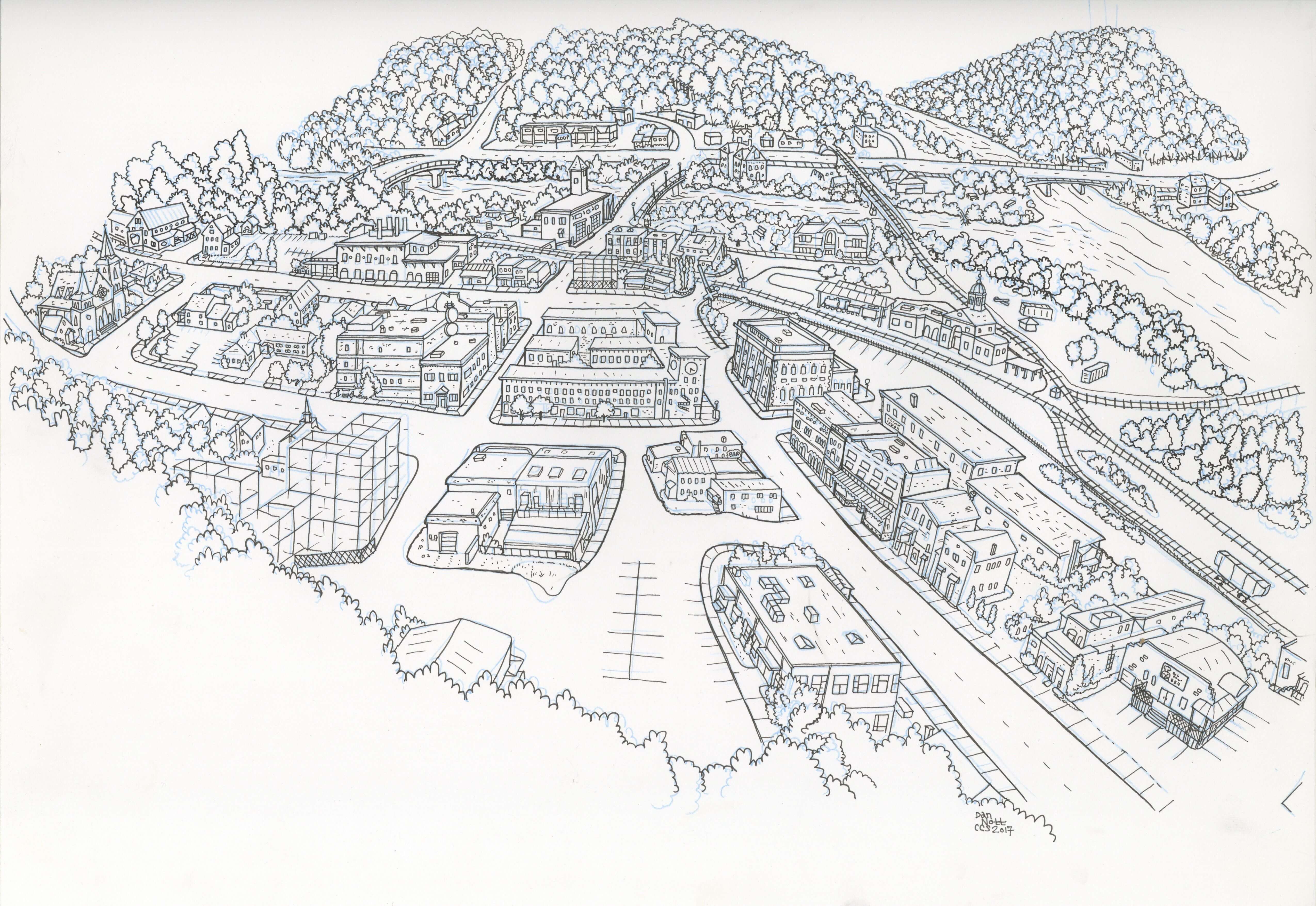
“I really loved the process and learned a lot about where I live. I think that capturing a sense of place is often about capturing the details that are easy to overlook, which together depict the history of the town. And by pulling back and seeing the town situated in its unique geography, it reveals what WRJ really is and what makes it special—a small community at the junction of rivers, railways, highways, and state lines. When you add CCS into the mix—a group of cartoonists converging on the town from all across the country and the world—it’s clear what a junction this place really is.” –Dan Nott ′17
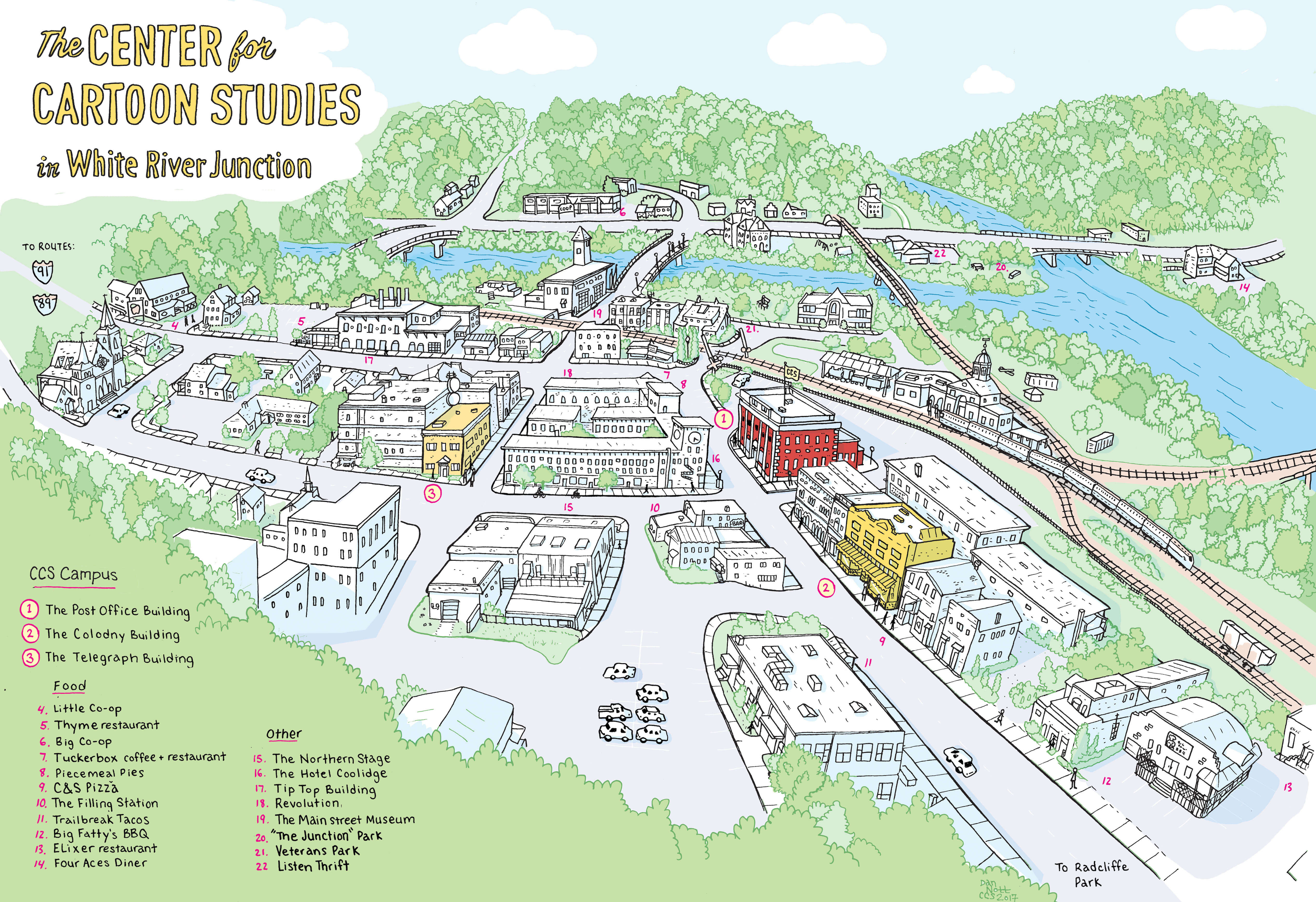
Early this year, Dan Nott ′17 drew a map of the historic village White River Junction for The Center for Cartoon Studies. The illustration is featured on the “Visit Us” page. Similarly, Alec Longstreth wrote a great comic about WRJ called Location, Location, Location. Angela Boyle ′16 spoke with Dan about the process for drawing this map.
In Dan’s own words:
I hadn’t created a map like this before, but I really liked the idea. I thought I lot about how I wanted to portray it. The map obviously had to show how to get around the town, but I also wanted it to illustrate the town’s unique geography and capture the sense of place. I spend a lot of time outside, and because White River Junction is, like, four streets, it’s easy to get to know the details of the town really well.
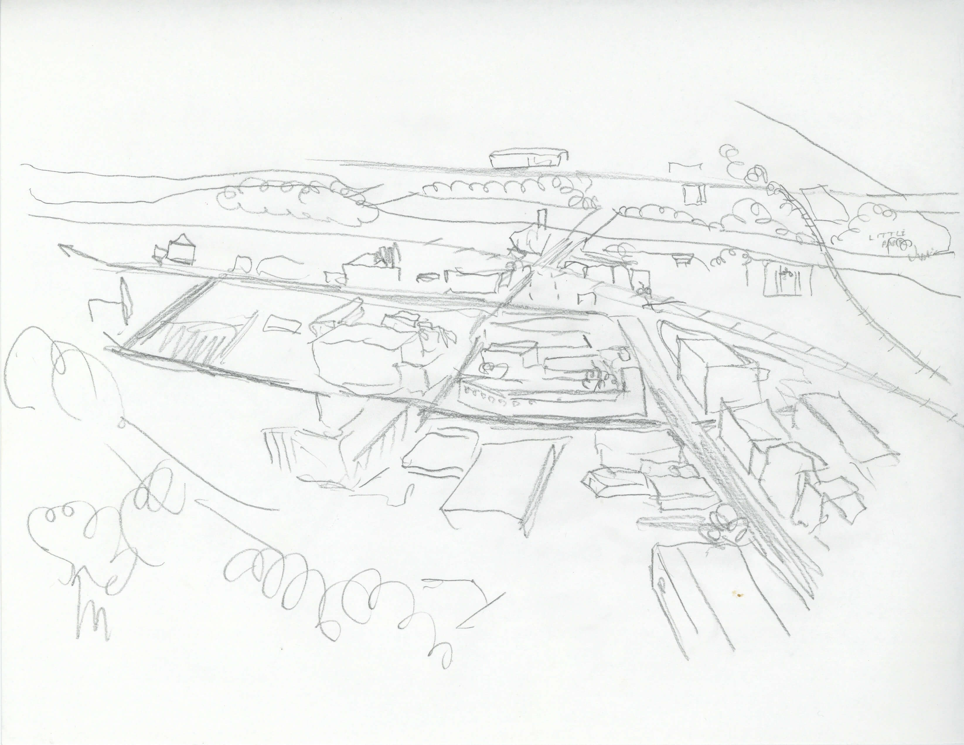
Rough sketch of WRJ
I tried a few different angles but decided to use an orientation that felt like you were viewing the town from a hill. This angle doesn’t really exist, so I had to be imaginative for this part. Working small, and looking at some satellite images, I drew the first image roughly to give a basic outline of the space.
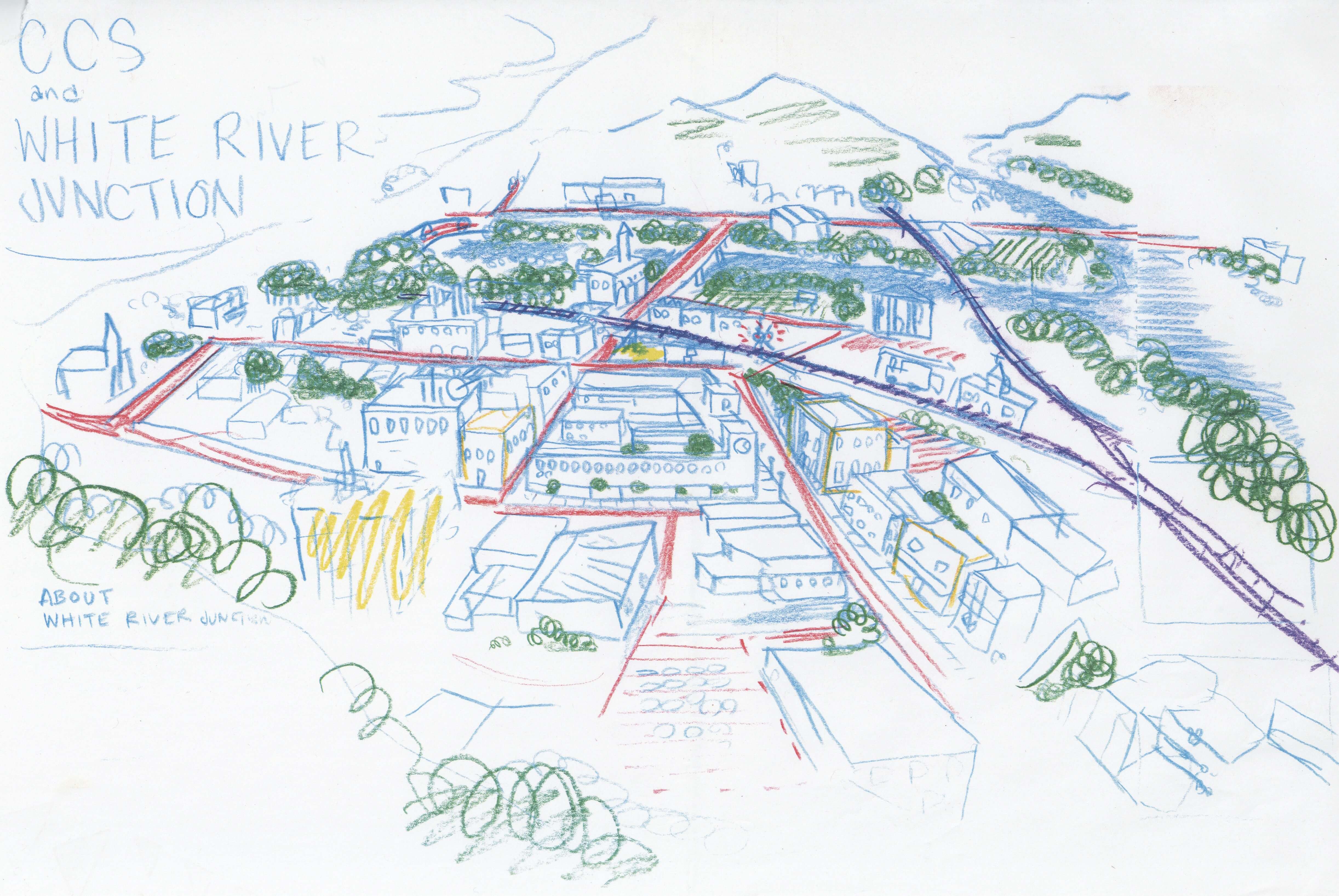
Filling in forms
Using that initial drawing as a guide, I started to fill in the forms and buildings using different colors to outline roads, railroad tracks, rivers, and hills that the town is nestled between.
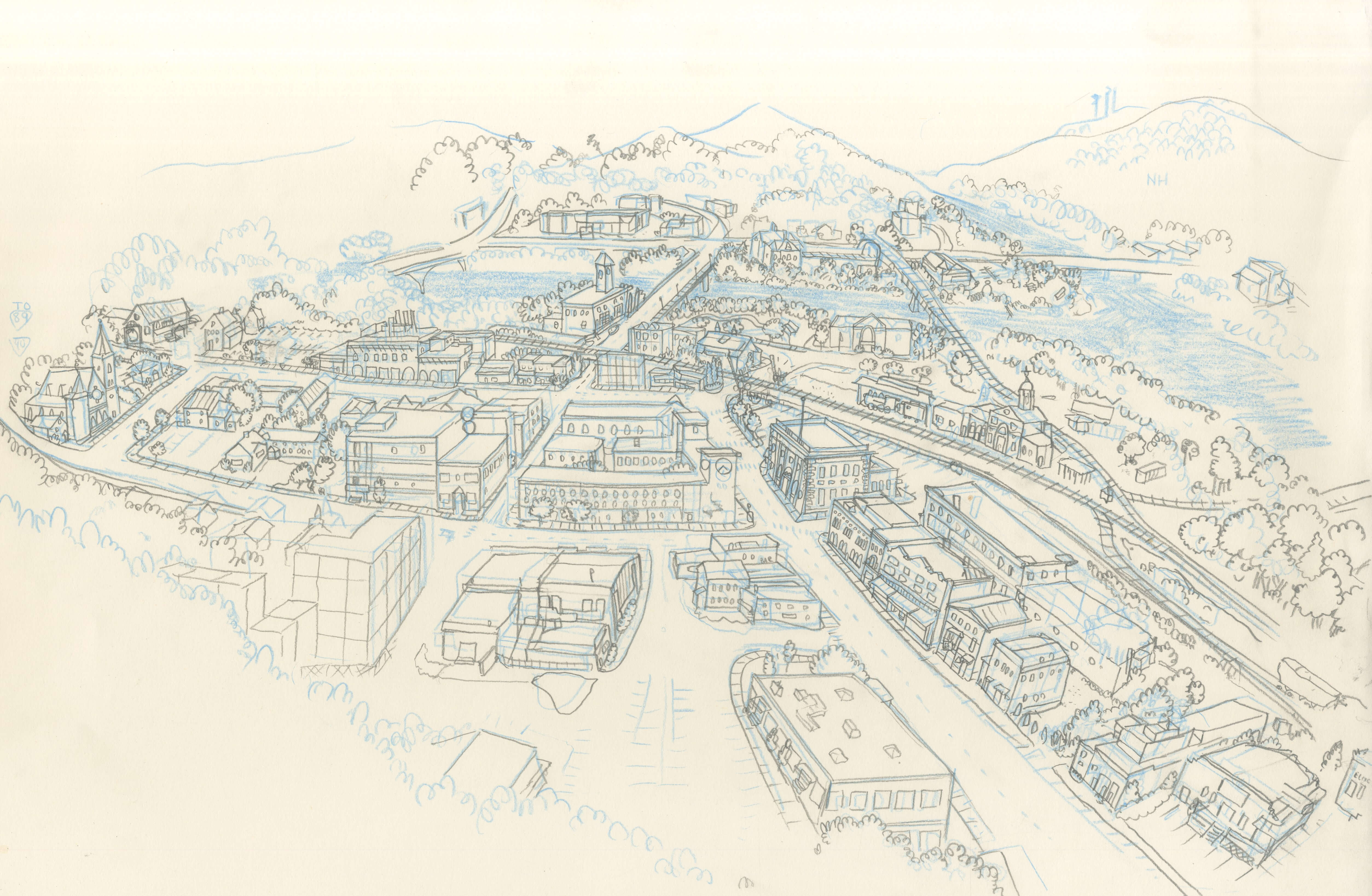
Pencil work of details on sketch paper
From there, I enlarged this rough drawing, traced it in blue onto large drawing paper, and walked around the town drawing and refining the individual buildings with a mechanical pencil. I had a few really nice days in summer where I spent most of the time drawing around town.
-
- St. Anthony Catholic Church
-
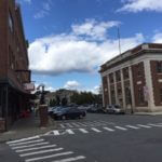
- CCS Post Office Building
-
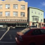
- CCS Colodony Building
-
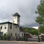
- Main Street Museum
Using a few dozen reference photos, I traced this drawing onto Bristol paper in blue pencil and inked it with a technical pen. Because White River Junction has been going through a bit of a building boom, and this process took a while, I had to draw in some of the under-construction buildings later on.
-
- St. Anthony Catholic Church
-
- CCS Post Office Building
-
- CCS Colodony Building
-
- Main Street Museum
I picked colors that would show the town as it might look on a sunny spring day. I joked that if CCS wanted to show the town in the winter, they could just grayscale the whole map.
Pencils on Bristol board
See more of Dan’s work at dannott.com
Here’s a recent link to an interview with Dan
Tags: Alec Longstreth, Dan Nott, Drawn to the village, Illustration, Location, map, process, Visit Us, White River Junction